Terra Incognita
The 5th of April
1722

The Island That Looked Back

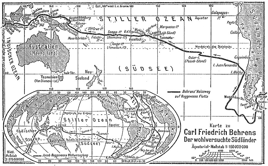
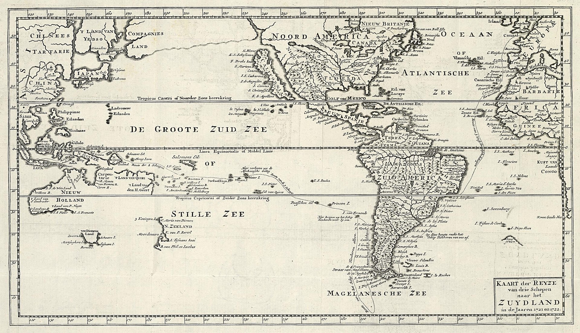
Three ships—the Arend, Thienhoven, and Afrikaansche Galey—sailed across an unmapped expanse. The horizon was a complete and unbroken circle. In the infinite Pacific, time collapsed. Weeks dissolved into salt and silence, until a shadow interrupted the sea.

The Dutch explorer Jacob Roggeveen discovers Easter Island — April 5, 1722

The Crossing

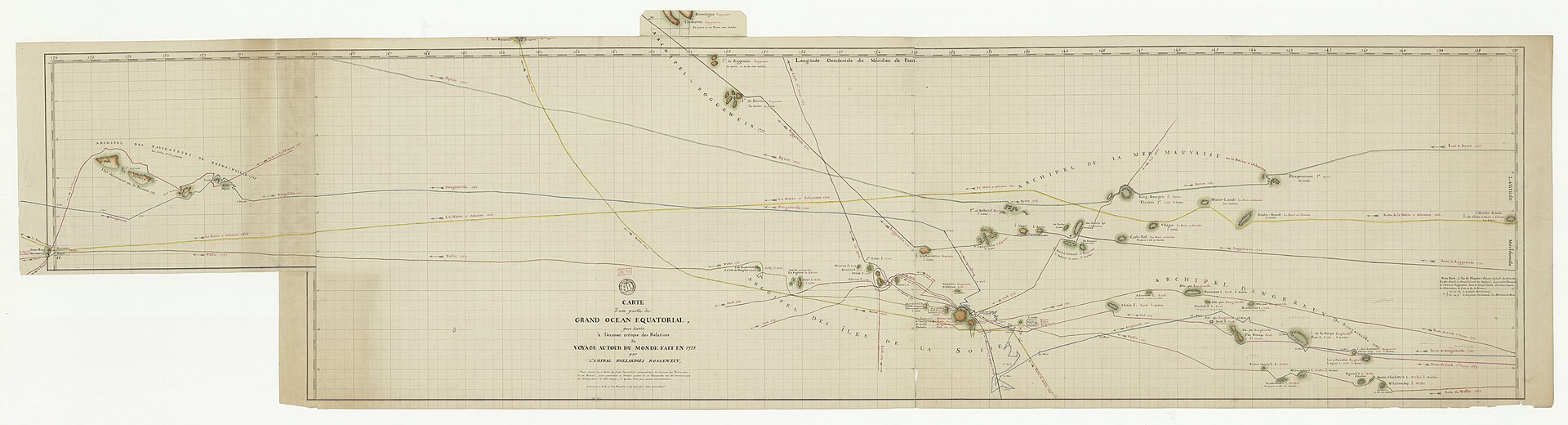
Jacob Roggeveen's expedition was fundamentally an act of faith in geography. Tasked with locating Terra Australis, the legendary Southern Continent, the Dutch fleet found only the immense emptiness of the world's largest ocean. Scurvy crept through the decks. Provisions rotted. The only constant was the punishing vastness of the Pacific waves.

December 1721
The fleet departs Texel, Netherlands, bound for the unmapped South Sea.
Early 1722
Navigating the treacherous winds of the Strait of Le Maire, entering the Pacific.
April 5, 1722
A silhouette is spotted on the horizon. Landfall.
Map of the voyage to the South Land by Jacob Roggeveen
Map of the voyage to the 'South Land' by Jacob Roggeveen. Credit: Dirk de Jong (Public domain)
Ship's Log — Roggeveen Expedition

The Ship's Log

December 1721 — Texel, Netherlands
“On the first of August we received our Commission from the Directors, and on the 21st of October we set sail from the Texel roads with three ships well furnished with men and all necessaries.”
Roggeveen, Journal — Departure from Texel
January 1722 — Strait of Le Maire
“The passage through the Strait was attended with the most frightful tempests and the most violent storms of wind and rain, with thunder and lightning, that any of us had ever witnessed.”
Carl Friedrich Behrens, eyewitness account
March 1722 — Open Pacific
“We had now been at sea for several months without sight of land. The men grew restless. The vastness of this ocean surpassed every account given by prior navigators. Still we searched for the Southern Continent.”
Composite — expedition journals
April 5, 1722 — Landfall
“We found it to be a low but fertile island, and named it Paasch Eyland, or Easter Island, from the time of our arrival. As we drew near we perceived figures of uncommon magnitude placed on the eminences.”
Roggeveen, Journal — Easter Sunday
Paasch-Eyland
Carte d'une partie du grand océan équatorial
Carte d'une partie du grand océan équatorial. Credit: Bibliothèque nationale de France

First Light

Easter Sunday, dawn. A dark contour emerged from the fog and ocean spray. At first, the sailors mistook the distant formations for trees or jagged peaks. But as the morning amber washed over the coastline, the truth became apparent. They were stone figures. Dozens of them.

Massive, geometric faces turned toward the sea, standing as sentinels on the cliffs. They faced outward, as if expecting exactly this moment. The Rapa Nui people were here first. The moai had been watching long before any European ship broke the horizon line.

Two Worlds,
One Shore

The encounter was an intersection of completely isolated realities. Roggeveen named the land Paasch-Eyland, honoring the holy day of their arrival. To the Rapa Nui, it was already the center of the world.

There was wonder on both sides, and profound misunderstanding. The Dutch offered trinkets; the Rapa Nui observed these pale strangers arriving on massive floating timbers. History frames this moment as a 'discovery,' yet standing beneath the towering gaze of the moai, the question remained open: who, truly, was being discovered?

Roggeveen voyage illustration
Roggeveen voyage. Credit: Carl Friedrich Behrens (Public domain)